The Population of the UK


The Population of the UK explains how geography - in the widest sense - makes a difference to life outcomes. It explains the geographical differences in key socio-economic variables - like education, health, and work - that illustrate the UK's stark social inequalities and affect everyone's lives.
Written for undergraduate students across social science disciplines, this unique text presents a social geography of the UK which:
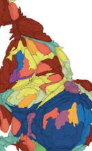
• Contains over 100 maps. These are drawn in proportion to the numbers of people being depicted and so represent the human geography of the UK in a fair way.
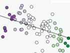
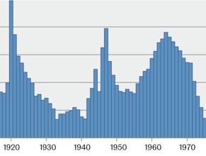
• Visualises quantitative evidence. The very latest statistics from numerous sources - including the 2010 election - reveal the many aspects of the underlying geographical structure of society in the UK.
• Relates geographies of identity to geographies of inequality, mortality, work, and settlement, and in a final chapter shows how the UK's population fits in to the world picture of who has most of what, and where.
Using the most advanced cartographic techniques of social mapping, The Population of the UK explains the nuts and bolts of UK population in comparative context.
This Website provides teaching and learning material in digital form and makes all data used to write this book available online:
• Overview & Introduction: Overview and resources for each chapter
• Maps & Figures: Overview of all maps and figures from the book
• Data: Original data used for the book including Excel and GIS files
• Further Resources: External links and other additional information
More of Danny’s work can be found on his website www.dannydorling.org. More maps from Ben are on his website www.viewsoftheworld.net.


Published by Sage
Did you know that where you were born
may affect when you die?