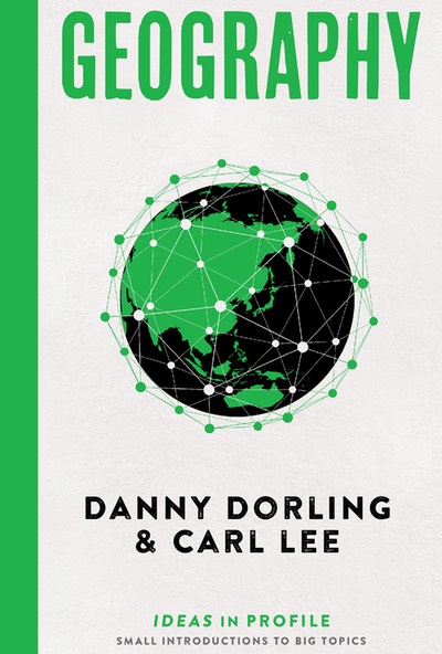
In the medieval European geographical tradition many versions of Mappa Mundi were produced – essentially maps of the known world at that time painted on cloth. In the modern version below, created digitally by Benjamin Hennig, the land area is proportional to human occupancy and the oceans are nearly eliminated. On such a map it is possible, just for the precise point at which the data were collected, to deduce the central pivot of human population – the centre of humanity at present. As we write, this is a small village, Badi Talai, lying in the arid hills just north of Udaipur, Rajasthan, India. On the world’s periphery on this Mappa Mundi are some of its currently core economic powers: North America, Europe and Japan.

Map: The Human Planet (© Benjamin Hennig)
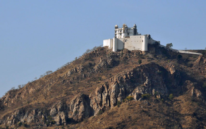
Photo: The Monsoon Palace, south of Udaipur a few kilometers from Badai Talai to the current gravitational pivot of human population